2026年10月23日 ハザードマップと地盤、物件を選ぶ前に確認しておくこと

2026年10月23日 ハザードマップと地盤、物件を選ぶ前に確認しておくこと
Hazard Maps and Ground Conditions: What to Check Before Choosing a Property
こんにちは。アンホーム(フォローアップ株式会社)の矢塚です。
Hello, this is Yatsuka from Anhome (Follow-Up Inc.).
■ 物件の「場所」に関するリスクを知っておく
住宅を購入するとき、建物の状態や間取りだけでなく、「その場所にどんなリスクがあるか」を確認しておくことが大切です。日本は地震・洪水・土砂災害などの自然災害が起きやすい地形を持っており、住宅を選ぶ際には地域ごとのリスクを把握することが基本的な確認事項の一つになります。
■ Knowing the Risks Associated With a Location
When choosing a home, it is important to look beyond the building itself and understand what risks may be associated with where it sits. Japan's geography means that earthquakes, flooding, and landslides are among the natural hazards that vary by area. Checking what applies to a specific location is a standard part of evaluating a property.
■ ハザードマップで確認できること
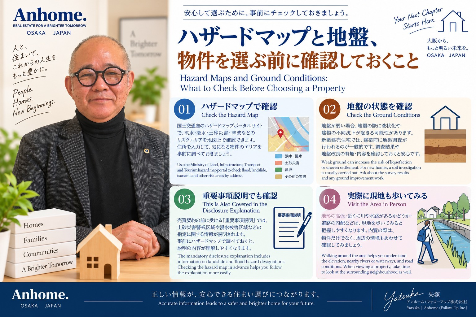
国土交通省が運営するハザードマップポータルサイトでは、洪水・浸水・土砂災害・津波などのリスクエリアを地図上で確認することができます。住所や地名を入力して調べられるため、気になる物件のエリアを事前に確認しておくことができます。
確認できる主な項目は、洪水が起きた場合の想定浸水深、土砂災害警戒区域の指定の有無、などです。これらはあくまで想定や区域指定であり、実際の被害を保証するものではありませんが、エリアのリスクを把握する参考になります。
■ What Hazard Maps Can Tell You
The hazard map portal operated by Japan's Ministry of Land, Infrastructure, Transport and Tourism allows anyone to look up flood risk, inundation depth projections, landslide risk zones, and tsunami hazard areas by address or place name. Checking a property's area on this map before visiting is a straightforward step that takes only a few minutes.
The information shows projected scenarios and designated risk zones rather than guarantees about actual outcomes, but it gives a useful picture of what has been assessed for a given area.
■ 地盤についても確認しておく
建物が建っている土地の地盤も、確認しておきたい項目です。地盤が弱い場合、地震の際に液状化が起きるリスクや、建物の不同沈下(一部が沈む現象)が生じる可能性があります。
新築建売住宅の場合、建築前に地盤調査が行われることが一般的です。調査結果や、それに基づいて行われた地盤改良の有無・内容を確認しておくと、安心材料の一つになります。調査報告書の開示については、担当者に確認してみてください。
■ Checking Ground Conditions
The ground on which a building stands is worth looking into as well. Weak soil can increase the risk of liquefaction during an earthquake, or cause uneven settlement in the building over time.
For new built-for-sale homes, a soil investigation is typically carried out before construction. Asking about the results of that survey and whether any ground improvement work was done, and what it involved gives you a clearer picture of what is underneath the property. Ask your agent about whether the survey report is available to review.
■ 重要事項説明でも触れられる内容
以前の記事で触れた「重要事項説明」の中には、土砂災害警戒区域や浸水被害区域などの指定に関する情報が含まれます。売買契約の前に宅地建物取引士から説明を受ける際、この部分もきちんと確認しておきましょう。
説明を受ける前にハザードマップで事前に調べておくと、説明の内容が頭に入りやすくなります。
■ This Also Comes Up in the Mandatory Disclosure Explanation
As mentioned in an earlier post, the formal disclosure explanation given before the sales contract covers information about landslide risk zones, flood hazard designations, and similar area classifications. Reviewing the relevant hazard map before that session makes it easier to follow along when those sections come up.
■ 自分の目でも確認しておく
ハザードマップや地盤の情報に加えて、実際に物件の周辺を歩いてみることも有効です。地形の高低・近くに川や水路があるかどうか・道路の勾配などは、現地に行ってみると把握しやすくなります。以前の記事でお伝えした「内覧のとき、周辺も歩いてみる」という考え方と同じです。
■ Your Own Eyes Matter Too
Beyond the maps and survey data, walking around the area yourself remains valuable. The elevation of the land relative to surroundings, proximity to rivers or waterways, and the slope of nearby roads are all things that are easier to read in person than on a screen. This connects to what was mentioned in an earlier post about walking the neighbourhood during or after a viewing.
■ ご相談はお気軽に
ハザードマップの見方や、地盤に関する確認の進め方についてご不明な点があれば、お気軽にご相談ください。
お電話:072-489-5661
アンホーム(フォローアップ株式会社)|大阪府知事(1)第63774号
■ Get in touch
If you have questions about how to read hazard maps or what to ask about ground conditions for a property you are considering, feel free to reach out.
Phone: 072-489-5661
Anhome (Follow-Up Inc.) | Osaka Prefectural Governor (1) No. 63774